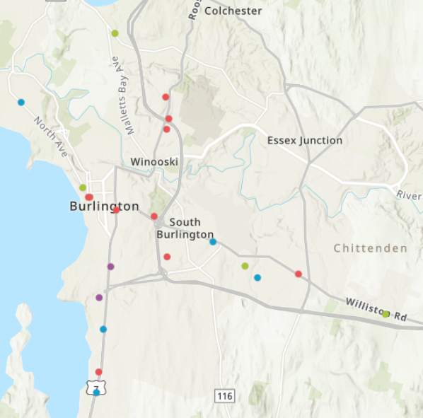
Each dot represents a valuable resource for pet protection during disasters in Chittenden County. The blue dots are veterinarians. The red dots are pet friendly hotels. The purple dots are pet shelters and advocacy organizations. The green dots are emergency services. In the interactive map (scroll down to access), you can click on a dot to access the name of the organization and its location.
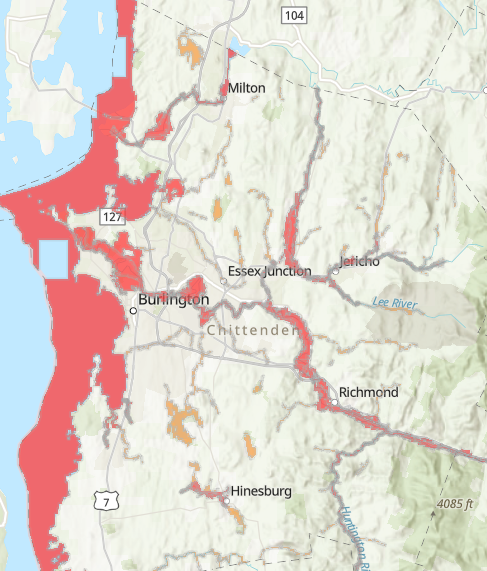
High-Risk Flood Zones in Chittenden County
Areas in red indicate high risk for flooding, while orange areas indicate less severe, but still important, risk for flooding. Use the interactive map (scroll down to access) to zoom in on your specific area and see if you live in a high risk zone.
Instructions on how to use the maps
Click on the small map in the bottom left corner of your screen to switch between the two map displays (high risk flood zones & resources). Use the buttons on the bottom right to zoom in and out on different areas throughout Chittenden County.
When you click on a point in the pet-friendly locations map, you will be able to see the organization’s name, address, and category type (pet friendly hotel, veterinarian, emergency pet service, or animal shelter/advocacy center).
The table underneath the map lists all of the information regarding the resources found on the map. You can choose to expand or collapse this table by clicking on the tab with the arrow located below the map display.